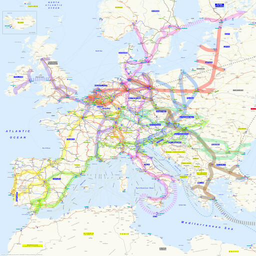
Interactive pvc map of Italy specific for Intermodal Transport. Highlighted in the cartography the motorway network and the main communication routes, the inter-modal lines with the various profiles (from PC / 22 to PC / 80), the Interports, the Intermodal Terminals, the main seaports and the European Corridors. By accessing the interactive function through a QRcode, you can find in-depth information on all Interports, Intermodal Terminals, Seaports, European Corridors and PC / 80 intermodal lines. All information within the interactive function is constantly updated and implemented
Desideri un preventivo o maggiori informazioni?