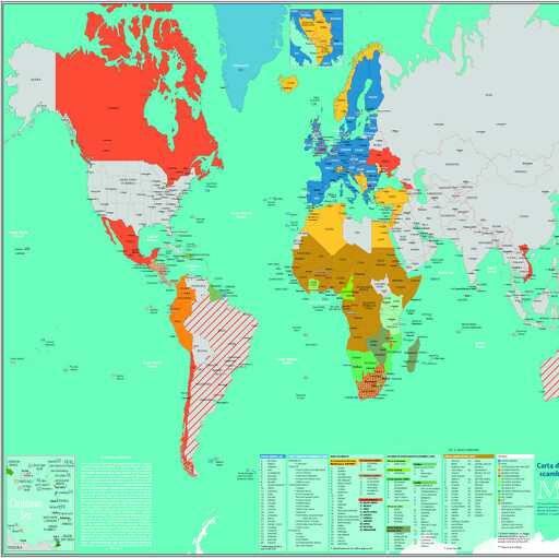
1st interactive pvc map of the Free Trade Economic Agreements between the EU and the world, but not only. The cartography highlights the countries and groups of countries that have signed agreements with the EU. By accessing the interactive function through a QRcode, you can consult the status of each individual country, as well as that of third countries, and their possible economic agreements signed directly between them. All the info inside the interactive function are continuously updated and implemented
Desideri un preventivo o maggiori informazioni?